Portneuf River at Batiste Road Bridge
Portneuf River at Batiste Road Bridge
Details
| Location | Latitude N: 42.913303741 Longitude W: -112.519835010 Elevation: Power County, Idaho, on downstream side of Batiste Road Bridge crossing, 50 ft west of the City of Pocatello Wastewater Treatment Facility, 1/4 mi west of the Bannock County line, 50 ft north of Interstate 15 West, and 3 mi west of Chubbuck. |
|---|---|
| Equipment | YSI 5920 multiparameter water quality sonde with temperature, specific conductance, pH, dissolved oxygen, and turbidity |
| Period of Record | 26 February 1998 – present during ice free conditions |
Photos
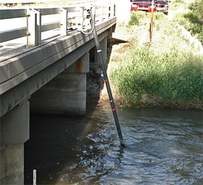
Monitoring boom has moderately high current velocity
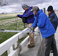
Amanda Rugenski, ISU, Mike Rowe, DEQ, and Sarah Bruer, ISU graduate student, use a bridge-board mounted winch to collect water and sediment samples
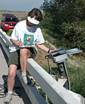
Irene Nautch records current readings